OUR PROJECTS
The PJB Surveying staff has enjoyed long term success in providing services to a vast array of clients throughout North Texas; such as Dallas Water Utilities (DWU), Dallas Public Works, Dallas County, TxDOT, NTTA, and the Cities of Carrollton, Frisco, Fort Worth, McKinney, Richardson and Plano. Associated projects have ranged in scale from smaller land development projects to miles of highway improvements.
PJB is committed to consistently providing all clients with a high quality of services that meet the needs of their project and exceed their expectations.
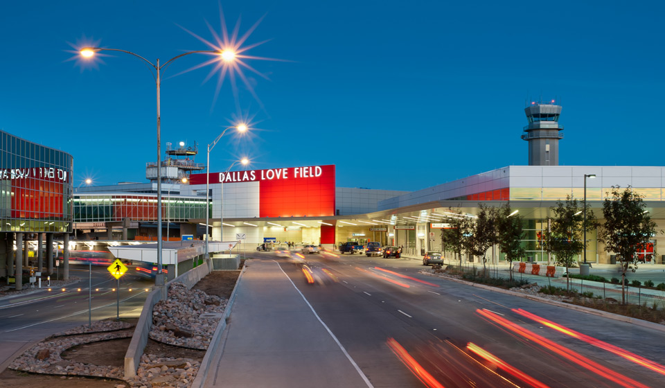
Dallas Love field industrial subdivision dallas public works & aviation
Mr. Baldasaro was entrusted to be the surveyor of record for this historic City of Dallas project. In the history of Dallas, this 1,350 plus acre plat is unrivaled in its intricacy and complexity. The Love Field Airport is comprised of nearly 1,700 properties. Mr. Baldasaro was tasked with researching and verifying each acquisition document (fee title, condemnation, quit claim) for the City; dating back to 1917. Additionally, all affected right-of-ways (dedicated or otherwise) were research and verified – and where necessary, abandoned and dedicated. In addition to the City of Dallas, other participants also included AT&T, DART, Southwest Airlines and B.M. Investments. The completed plat amassed 63 sheets and was filed in November of 2015.

university park
PJB Surveying was tasked to reestablish the common boundary line of NTTA property and Germany Park, in University Park, at the southeast corner of University Boulevard and the Dallas North Tollway. Comprehensive research was performed both online and in the City of Dallas Records Vault, to retrace the tracts from the early 1930’s, when the St. Louis & Southwestern Railroad ran through the area, to the early 1960’s when the Texas Turnpike Authority purchased the railroad to build a Tollway, to the late 1960’s when a portion was purchased from the adjacent HOA and finally to the 1970’s when the nearby area was de-annexed from the City of Dallas and transformed into a Park. With the assistance of several “strip” maps found in the survey records vault, and even old aerial photography, PJB Surveying was able to recover sufficient record monuments to determine the location of the current east Right-of-Way line of the Dallas North Tollway.

Plano Parkway Sidewalk Improvements
PJB Surveying provided over 3,000 LF of topographic survey and nearly 12,000 LF of right-of-way recovery. Required for the design of future sidewalks, PJB performed design surveys that included existing roadways, sidewalks, medians, driveways, visible utilities, bridge features, creek location, trees and fences. PJB also created custom GeoPak SMD files to generate topo features to the client’s requirements. Additionally, PJB also provided the office and field services necessary to recover the limits of Plano Parkway, and adjacent ownership, from Alma Road to Custer Road, allowing for the design of sidewalks within existing right-of-way; or the identification of required easements.
Interstate I-20
As Survey Manager, Mr. Baldasaro was tasked with providing ROW Mapping services for this corridor from Camp Wisdom Road to Main Street, in Dallas County. This project required the recovery of the existing state right-of-way, reconstruction of adjoining properties, recovery of monumentation, delineation of Control of Access Line(s) verification of acquisitions, verification of Project Control, preparation of Exhibit ‘A’ Documents, and the preparation of updated Right-of Way Maps.
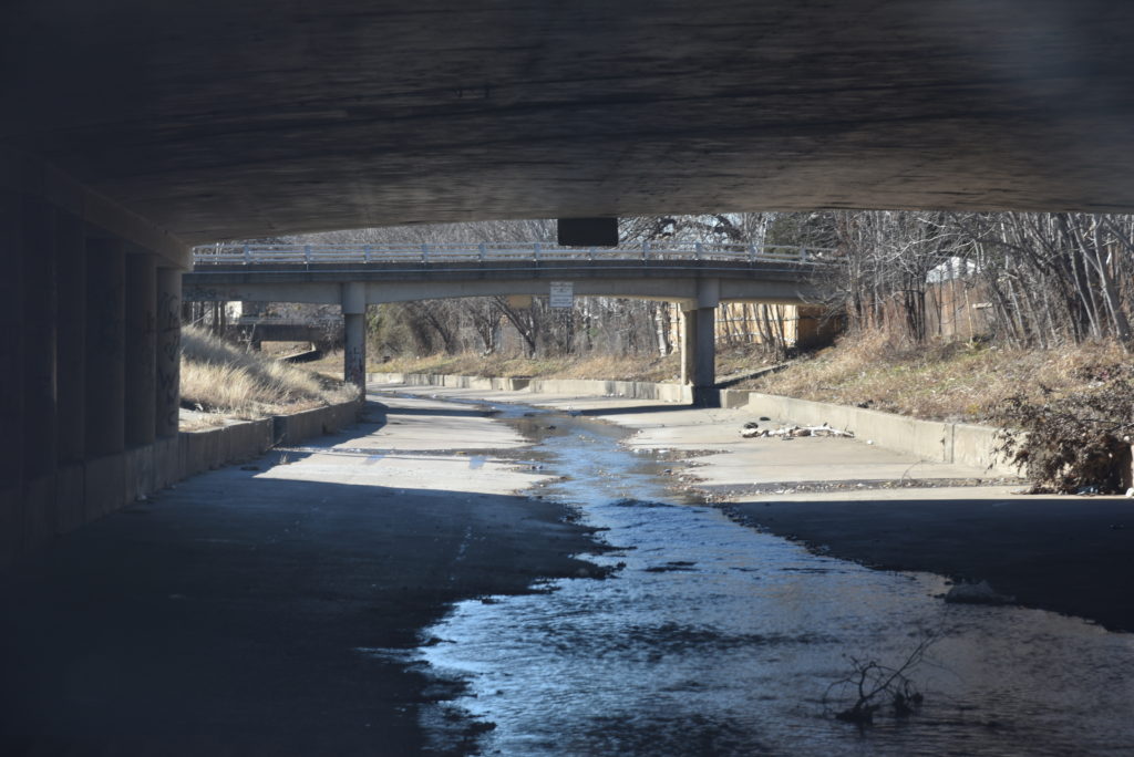
joe's creek - dallas water utilities
PJB Surveying was tasked to reestablish the common boundary line of NTTA property and Germany Park, in University Park, at the southeast corner of University Boulevard and the Dallas North Tollway. Comprehensive research was performed both online and in the City of Dallas Records Vault, to retrace the tracts from the early 1930’s, when the St. Louis & Southwestern Railroad ran through the area, to the early 1960’s when the Texas Turnpike Authority purchased the railroad to build a Tollway, to the late 1960’s when a portion was purchased from the adjacent HOA and finally to the 1970’s when the nearby area was de-annexed from the City of Dallas and transformed into a Park. With the assistance of several “strip” maps found in the survey records vault, and even old aerial photography, PJB Surveying was able to recover sufficient record monuments to determine the location of the current east Right-of-Way line of the Dallas North Tollway.
FM 3537 (Main St.)
Survey Manager for right-of-way survey services for F.M. 3537 in Frisco for TxDOT and the City of Frisco. Initially contracted to review previous consultant’s boundary reconstruction and parcel creations, Patrick provided TxDOT a detailed summation of findings, which included several inconsistencies. As a result of the thorough review, Patrick subsequently received additional Work Authorizations and Contracts from TxDOT and the City of Frisco respectively. Contracted services included verification and delineation of original State of Texas Right-of-Way, the preparation of legal descriptions and parcel plats for additional right-of-way needed for future construction, and all necessary easements required to complete the project, as well as the creation of TxDOT Right-of-Way Maps of the project area.